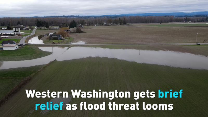
Western Washington residents are breathing a cautious sigh of relief as floodwaters begin to recede across the state. However, the U.S. National Weather Service has made it clear that the danger isn’t over: new flood watches are in effect through midweek, and several flood warnings remain active.
The recent storm left the ground saturated after heavy rain, overwhelming rivers and sending communities into crisis mode. Cleanup efforts are now underway as volunteers and local crews work to clear debris, restore power, and reopen critical roadways.
“We’ve seen water levels drop,” said a spokesperson for the National Weather Service, “but with another wave of rain moving in, rivers could rise again quickly.” Forecasters point to an incoming system that could dump additional rain on already soggy soils, raising the risk of renewed flooding in low-lying areas.
For travelers and digital nomads planning a Pacific Northwest adventure, the situation remains fluid. Road closures and delays could affect popular routes, especially along rivers that are still running high. Residents in flood-prone counties are advised to stay alert, monitor local updates, and follow evacuation orders if issued.
This pattern of intense, back-to-back storms reflects a broader trend of extreme weather events seen around the world. As climate change continues to influence rainfall patterns, communities from Washington state to Europe and beyond are grappling with the challenge of adapting to more unpredictable and severe weather.
Authorities urge everyone in the affected areas to heed warning alerts, plan for potential power outages, and keep emergency kits on hand. While the brief lull offers a chance to assess damage and begin repairs, the coming days will be critical in determining whether Western Washington can avoid another surge of floodwaters.
Roza Kazan reports.
Reference(s):
cgtn.com