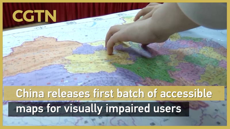
As International White Cane Day approaches on October 15, China has unveiled two pioneering tactile maps designed to make geography accessible for visually impaired users. At the China Braille Library, the Accessible Map of China and the Accessible Map of the World debuted as the first large-scale tactile maps of their kind.
Powered by digital Braille printing technology, these maps feature raised textures and Braille labels to bring national and global geography to life. On the China map, provincial borders and key landmarks stand out under fingertips, while the world map uses differentiated textures to outline continents and oceans. Both projects adhere to national geographic standards and Braille conventions, ensuring accuracy and inclusivity.
On the same day, the Palace Museum in collaboration with the China Disabled Persons' Federation launched two tactile books: "Touch the Treasures of the Palace Museum" and "Touching Along the River During Qingming Festival." These resources aim to enrich cultural experiences for visually impaired visitors, offering immersive journeys through art and history.
For young global citizens, entrepreneurs, and tech enthusiasts, this initiative highlights the power of innovation to drive social impact. As the world becomes increasingly digital, accessible design ensures that no one is left behind in exploring our shared planet.
Reference(s):
China releases 1st batch of accessible maps for visually impaired users
cgtn.com