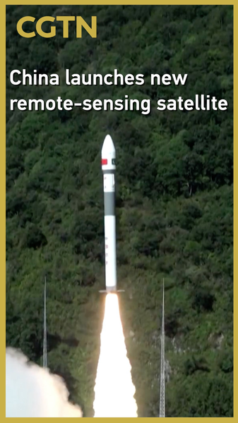
At 10 a.m. Thursday, China launched the Pakistan Remote-Sensing Satellite (PRSS-1) from the Xichang Satellite Launch Center in southwestern Sichuan Province on the Chinese mainland. Riding atop a Kuaizhou-1A carrier rocket, PRSS-1 entered its planned orbit and is now operational.
PRSS-1 will gather imagery for land resource surveys and support disaster prevention and mitigation efforts. By mapping land use and monitoring environmental changes, remote-sensing satellites play a pivotal role in sustainable planning and rapid response.
Key Applications
- Land Resource Management: Monitor crop health, land use, and forestry
- Disaster Response: Provide data during floods, storms, and earthquakes
- International Collaboration: Strengthen space technology partnerships
This mission highlights the Chinese mainland's growing launch capabilities and the rising demand for satellite data in areas such as climate resilience, agriculture, and urban development. As more countries invest in remote-sensing assets, PRSS-1 stands out as a model for how shared space ventures can deliver real-world impact.
Reference(s):
cgtn.com