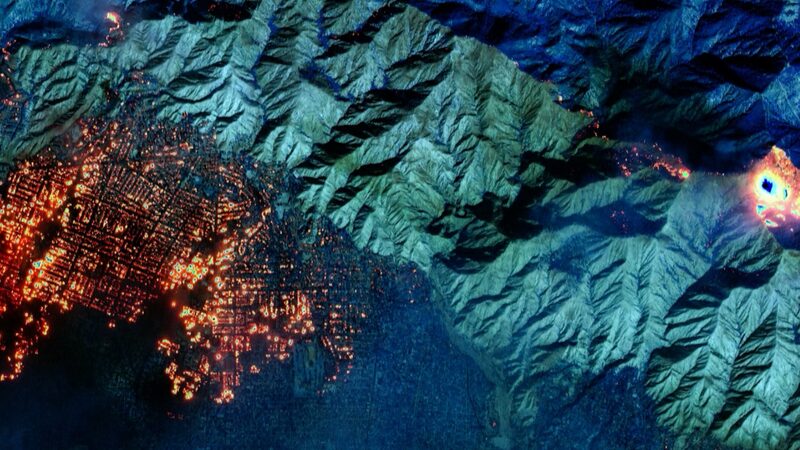
Satellite images captured from space on January 8 revealed multiple wildfires raging uncontrollably across Los Angeles, leaving a trail of destruction in their wake.
These fierce fires, which ignited on January 7, have tragically claimed at least five lives and compelled over 100,000 residents to evacuate their homes in a desperate bid for safety.
The blazes have left more than 400,000 homes and businesses in California without electricity, underscoring the extensive impact of the infernos on the community and infrastructure.
Authorities are working tirelessly to contain the fires and restore power to affected areas, but the situation remains critical as efforts continue to combat the widespread devastation.
Reference(s):
cgtn.com