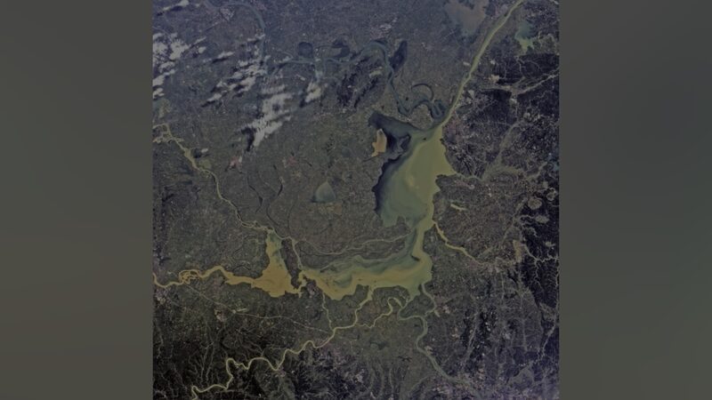
Following a Friday dike breach at Dongting Lake, the Chinese mainland's second-largest freshwater lake in central Hunan Province, rescue and relief operations have been significantly bolstered by the deployment of advanced satellite technology.
The China Centre for Resources Satellite Data and Application (CRESDA) has mobilized several remote sensing satellites, including Gaofen-3 02, Gaofen-3 03, Gaofen-1, and Gaofen-4, to provide real-time monitoring of the affected areas. These satellites offer valuable data that is crucial for effective disaster response.
As of Saturday, satellite imaging has been conducted five times, ensuring that relevant departments receive timely and accurate information to guide their efforts. The swift provision of this data highlights the role of satellite technology in enhancing the efficiency and effectiveness of disaster relief operations.
Reference(s):
Central China's dike breach: Satellites join relief operations
cgtn.com