On January 7, a powerful magnitude-6.8 earthquake struck Dingri County in Xigaze, located in southwest China's Xizang Autonomous Region. Nestled on the northern slope of the Himalayas at an average altitude of 4,500 meters, the county is near the northern base camp of Mount Qomolangma. The epicenter in Tsogo Township impacted 27 villages, affecting approximately 6,900 residents within a 20-kilometer radius.
The earthquake has resulted in the tragic loss of at least 126 lives, with 188 individuals injured. More than 600 aftershocks have been recorded, adding to the challenges faced by the affected communities. Professor Ma Changqian from the China University of Geosciences highlighted the region's high-altitude mountainous terrain, characterized by valleys, steep slopes, and rugged landscapes, which increase the likelihood of landslides and mudslides. These natural barriers have obstructed access to the epicenter, complicating rescue efforts.
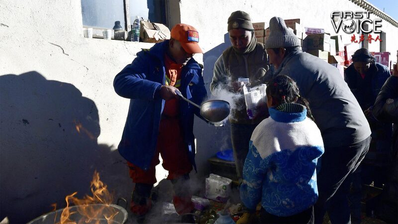
Compounding these difficulties are the harsh winter conditions, with night-time temperatures dropping below freezing. The freezing environment poses significant risks to both the injured and the rescuers. Additionally, aerial and ground-based rescue missions are often hindered by unpredictable weather, including heavy snowfalls, strong winds, and low visibility. Despite these formidable obstacles, the people of Xizang remain determined to recover and rebuild, demonstrating remarkable resilience in the face of natural disasters.
Reference(s):
With people at the center, Xizang will come out of the crisis stronger
cgtn.com