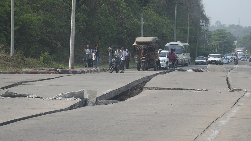
A powerful 7.7 earthquake struck central Myanmar on Friday, resulting in widespread devastation and a confirmed death toll of 1,644. The impact of this natural disaster has drawn attention from experts who are now shedding light on the underlying seismic forces at work.
Experts from the China Earthquake Networks Center have analyzed the event and traced its origin to the Myanmar Arc. This region, positioned at the eastern tectonic junction of the Himalayan belt, experiences significant crustal deformation because of intense collisions between the Indian and Eurasian plates since the Cenozoic era.
Historical data reveals that since 1900, at least ten earthquakes of magnitude 7.0 or higher have rattled areas within a 300-kilometer radius of the latest epicenter. Notably, a massive 8.0-magnitude quake on May 23, 1912, stands as a stark reminder of the region's persistent seismic activity.
As the region grapples with the aftermath of this earthquake, specialists emphasize the need for enhanced preparedness and resilience. By marrying data-driven insights with historical context, this analysis offers a clearer picture of the tectonic dynamics that make the Myanmar Arc one of the most earthquake-prone areas in the world.
Reference(s):
cgtn.com


