The Chinese mainland's National Meteorological Center has issued its first red alert for the year, signaling the highest level of warning for Typhoon Gaemi. The alert was announced at 10 a.m. on Wednesday as the typhoon approaches.
Typhoon Gaemi is expected to make landfall along the coast of the central or northern Taiwan region on Wednesday night. After crossing the island, it is projected to make landfall between Thursday afternoon and midnight along the coast between Fuding and Jinjiang cities in Fujian province, according to meteorological authorities.
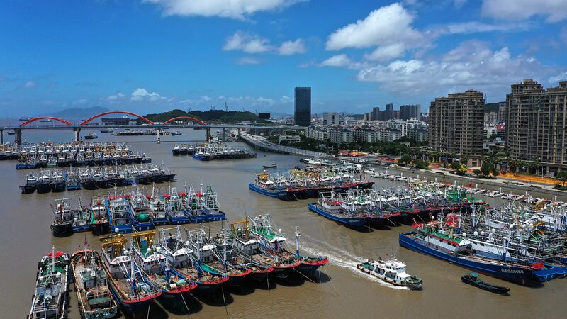
In response to the approaching typhoon, Fujian provincial flood control and drought relief headquarters elevated the emergency response level for typhoons from Level III to Level II, the second-highest level. Additionally, a Level IV emergency response has been activated for rainstorms, which is the least severe of the four-tier response system.
Due to the influence of Typhoon Gaemi, rainstorms are expected to impact many parts of Fujian over the next three days. The province's central and northern coastal areas may experience accumulated rainfall of up to 350 millimeters, with some regions potentially exceeding 600 millimeters.
Reference(s):
China issues this year's first red alert for typhoon, E China gears up
cgtn.com