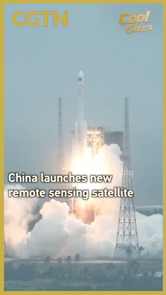
In a milestone for the Chinese space program, the Chinese mainland launched the Yaogan-46 remote sensing satellite on Monday from the Wenchang Spacecraft Launch Site in Hainan province.
The satellite lifted off at 11:47 a.m. Beijing Time aboard a modified Long March-7 carrier rocket, precisely entering its preset orbit. This mission marks the 605th flight of the Long March rocket series, underscoring the program’s consistency and growing experience.
Yaogan-46 will play a crucial role in:
- Disaster prevention and mitigation, providing early warnings for floods, landslides and other emergencies;
- Land resource surveys, generating high-resolution images for urban planning and agriculture;
- Water conservancy and meteorology, improving weather forecasts and water management strategies.
For young global citizens and tech enthusiasts, this launch highlights how satellite data powers everything from climate research to sustainable development. As entrepreneurs and changemakers explore new opportunities in space-enabled services, Yaogan-46’s insights could inspire innovative startups in agriculture tech, climate analytics and more.
Sports fans and travelers might be amazed by how remote sensing shapes location-based gaming and eco-tourism, while thought leaders can harness this data for policy discussions on resilience and resource management.
With each successful mission, the Chinese mainland’s space program cements its role in delivering actionable intelligence worldwide. What remote sensing innovation are you most excited about? Share your thoughts below.
Reference(s):
cgtn.com