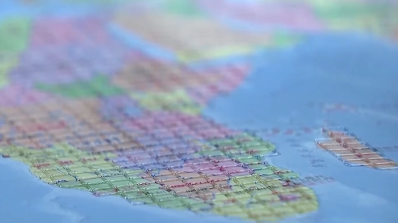
On October 15, ahead of International White Cane Day, the China Braille Library in Beijing unveiled two groundbreaking tools: the Accessible Map of China and the Accessible Map of the World.
These large-scale maps harness cutting-edge digital Braille printing technology to bring geography to life for visually impaired readers. The China map features raised lines marking provincial boundaries and major landmarks, while the world map uses distinct textures to differentiate continents from oceans. Both maps adhere to national geographic standards and Braille conventions, ensuring an accurate and inclusive window into our planet.
In a parallel launch, the Palace Museum and the China Disabled Persons' Federation introduced two tactile books: “Touch the Treasures of the Palace Museum” and “Touching Along the River During Qingming Festival”. These books combine raised textures, Braille labels, and audio guides so readers can explore cultural relics through touch and sound.
By weaving together technology and tradition, these initiatives set a new benchmark for inclusive design and cultural accessibility, inviting everyone to explore the world through multiple senses.
Reference(s):
China unveils first accessible maps for visually impaired users
cgtn.com