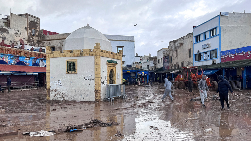
Seven major river basins in the Chinese mainland are at risk of flooding during the upcoming flood season, creating a challenging flood defense scenario, according to an official from the Ministry of Water Resources on Sunday.
Forecasts indicate that precipitation will primarily affect the northern regions, with southern areas expecting less rainfall from late July to early August.
Regions such as the Songhua River and the Liao River, the Haihe River Basin (including the Zhangwei River and Ziya River), the middle and lower reaches of the Yellow River, the Huaihe River Basin (Yi-Shu-Si Water System), the upper reaches of the Yangtze River, and the Hanjiang River are anticipated to receive 20% to 50% more rainfall.
Conversely, the southern Yangtze River Basin (Dongting Lake and Poyang Lake water systems), the Pearl River Basin (Beijiang River, Dongjiang River, and Hanjiang River), and the Minjiang River are expected to experience 20% to 50% less rainfall.
Global warming has intensified the water cycle, increasing saturated water vapor. Studies show that for every 1°C rise in atmospheric temperature, the water vapor content in the atmosphere increases by 7%, heightening the likelihood of extreme rainstorms that can trigger floods in small and medium-sized rivers, mountain torrents, and urban areas. These conditions present significant challenges to flood prevention and disaster relief efforts.
The Ministry of Water Resources official also highlighted the presence of numerous small and medium-sized reservoirs, dangerous reservoirs, and silt dams in the Chinese mainland, many of which have low flood resistance and pose substantial flood control risks. Additionally, ongoing water conservancy projects slated for construction this year may need to proceed during the flood season, further elevating safety risks.
Reference(s):
cgtn.com